
All categories
 Earth Science Books
Books from the BGS and other publishers on a wide range of earth science topics.
Earth Science Books
Books from the BGS and other publishers on a wide range of earth science topics.
 1:250 000 Geological Maps (UTM Series)
Maps in this series show three sorts of geological information: solid 'bedrock' geology, (S), Quaternary or 'drift' geology (Q), or sea-bed sediments (Ss).
1:250 000 Geological Maps (UTM Series)
Maps in this series show three sorts of geological information: solid 'bedrock' geology, (S), Quaternary or 'drift' geology (Q), or sea-bed sediments (Ss).
 Geological Memoirs - Scotland
Geological memoirs for each of the 1:50 000 series (and the earlier one-inch series) geological map sheets.
Geological Memoirs - Scotland
Geological memoirs for each of the 1:50 000 series (and the earlier one-inch series) geological map sheets.
 Other Minerals Publications
Miscellaneous publications on UK minerals exploration.
Other Minerals Publications
Miscellaneous publications on UK minerals exploration.
 1:250 000 Geological Maps (UTM Series)
Solid 'bedrock' geology, Quaternary or 'drift' geology and sea-bed sediment maps for offshore areas
.
1:250 000 Geological Maps (UTM Series)
Solid 'bedrock' geology, Quaternary or 'drift' geology and sea-bed sediment maps for offshore areas
.
 Mineral Reconnaisance Reports
These reports provide information and maps related to exploration and development of Britain's mineral resources.
They were produced under the Minerals Reconnaisance Programme, funded by the Department of Trade and Industry (DTI) between 1972 and 1997. The reports contain the results of reconniassance and follow-up mineral exploration surveys, new evidence of mineralisation in Britain, and recommendations for further work.
Mineral Reconnaisance Reports
These reports provide information and maps related to exploration and development of Britain's mineral resources.
They were produced under the Minerals Reconnaisance Programme, funded by the Department of Trade and Industry (DTI) between 1972 and 1997. The reports contain the results of reconniassance and follow-up mineral exploration surveys, new evidence of mineralisation in Britain, and recommendations for further work.
 1:25 000 Classical Areas Map Series
Some areas of outstanding geological interest warrant maps greater detail than is shown on the 1:50 000 Series geological maps.
1:25 000 Classical Areas Map Series
Some areas of outstanding geological interest warrant maps greater detail than is shown on the 1:50 000 Series geological maps.
 Regional Geology Guides
 provide an overview of the geology of individual regions of the United Kingdom. In addition to explanatory text, they contain maps, diagrams, sections and photographs. These guides provide a comprehensive description of the geology of the regions: they are suitable for informed amateurs, geology students and professionals alike. Format: 152 x 243mm; paperback..
Regional Geology Guides
Regional Geology Guides provide an overview of the geology of individual regions of the United Kingdom. In addition to explanatory text, they contain maps, diagrams, sections and photographs. These guides provide a comprehensive description of the geology of the regions: they are suitable for informed amateurs, geology students and professionals alike. Format: 152 x 243mm; paperback..
 BGS International Regional Geochemistry Data
Regional geochemical data from a range of overseas countries are available for sale on a series of CD-ROMs.
BGS International Regional Geochemistry Data
Regional geochemical data from a range of overseas countries are available for sale on a series of CD-ROMs.
 Directory of Mines and Quarries
These directories provide information on working mines and quarries in the United Kingdom. Summary details of rock types or minerals, geological formation, location and owner or operator are provided.
Directory of Mines and Quarries
These directories provide information on working mines and quarries in the United Kingdom. Summary details of rock types or minerals, geological formation, location and owner or operator are provided.
 UK Thematic Resource Maps
Resource maps for coal, building stone, industrial minerals, metalliferous minerals and energy resources are published at c. 1:150 000 scale.
UK Thematic Resource Maps
Resource maps for coal, building stone, industrial minerals, metalliferous minerals and energy resources are published at c. 1:150 000 scale.
 Minerals Programme Publications
Publications of the DTI-funded Minerals Programme which commenced in 1998.
Minerals Programme Publications
Publications of the DTI-funded Minerals Programme which commenced in 1998.
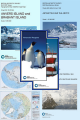 British Antarctic Survey Books and Maps
Geoscience, environmental and topographic maps and guides produced by the British Antarctic Survey.
British Antarctic Survey Books and Maps
Geoscience, environmental and topographic maps and guides produced by the British Antarctic Survey.
 Geochemical Atlases
These atlases provide a systematic picture of the geochemistry of the whole of Britain.
Geochemical Atlases
These atlases provide a systematic picture of the geochemistry of the whole of Britain.
 Earthwise™ Books
The Earthwise™ books cover a range of topics from the influence of geology on the taste of a good single malt, to the causes and effects of earthquakes.
Earthwise™ Books
The Earthwise™ books cover a range of topics from the influence of geology on the taste of a good single malt, to the causes and effects of earthquakes.
 Posters and gifts
A selection of Geological and scientific posters and gifts are available that illustrate geology in a popular, non-scientific way.
Posters and gifts
A selection of Geological and scientific posters and gifts are available that illustrate geology in a popular, non-scientific way.
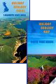 Earthwise™ Holiday Geology Guides and Maps
These concise guidecards provide a wealth of information on the geology of many popular tourist areas of England,
ranging from heritage coasts to London’s historic buildings.
Earthwise™ Holiday Geology Guides and Maps
These concise guidecards provide a wealth of information on the geology of many popular tourist areas of England,
ranging from heritage coasts to London’s historic buildings.
 1:10 000 Geological Maps
.
1:10 000 Geological Maps
1:10 000 Geological Maps.
 Miscellaneous Regional Guides
Various guide-books on the geology of the United Kingdom.
Miscellaneous Regional Guides
Various guide-books on the geology of the United Kingdom.
 Confidential Borehole Records
A small percentage of the boreholes we hold are confidential. We can display the location and name of these boreholes, but permission to release the data must be sought from the owners before we can supply more detailed information.
Confidential Borehole Records
A small percentage of the boreholes we hold are confidential. We can display the location and name of these boreholes, but permission to release the data must be sought from the owners before we can supply more detailed information.
 British Regional Geology Guides
Regional Geology guides provide an overview of the geology of individual regions of the United Kingdom.
British Regional Geology Guides
Regional Geology guides provide an overview of the geology of individual regions of the United Kingdom.
 Earthwise™ Books
The Earthwise™ books cover a range of topics from the influence of geology on the taste of a good single malt, to the causes and effects of earthquakes. Suitable for the interested amateur, these books provide an insight into various aspects of geology and offer a wide range of information.
Earthwise™ Books
The Earthwise™ books cover a range of topics from the influence of geology on the taste of a good single malt, to the causes and effects of earthquakes. Suitable for the interested amateur, these books provide an insight into various aspects of geology and offer a wide range of information.
 Scottish Natural Heritage Books and Guides
Scottish Natural Heritage in association with the BGS have produced a range of booklets on the geology and landscape of several important tourist regions of Scotland.
Scottish Natural Heritage Books and Guides
Scottish Natural Heritage in association with the BGS have produced a range of booklets on the geology and landscape of several important tourist regions of Scotland.
 Earthwise™ Holiday Geology Guides
These concise guidecards provide a wealth of information on the geology of many popular tourist areas of England, ranging from heritage coasts to London’s historic buildings. They feature many colour diagrams and photographs and are produced as folded A3 laminated cards.
Earthwise™ Holiday Geology Guides
These concise guidecards provide a wealth of information on the geology of many popular tourist areas of England, ranging from heritage coasts to London’s historic buildings. They feature many colour diagrams and photographs and are produced as folded A3 laminated cards.
 Geological Novelties
Geologically themed Mugs, Coasters and more
Geological Novelties
Geologically themed Mugs, Coasters and more
 Classical Areas
Descriptions of the geology of parts of Britain which are of special geological interest.
Classical Areas
Descriptions of the geology of parts of Britain which are of special geological interest.
 GeoSections Synthetic Boreholes
Place a point on a map and obtain a prediction of the depths of the modelled units at that location.
GeoSections Synthetic Boreholes
Place a point on a map and obtain a prediction of the depths of the modelled units at that location.
 GeoSections Horizontal Sections
Select a rectangular area on a map and obtain a geological map at an elevation below the ground surface.
GeoSections Horizontal Sections
Select a rectangular area on a map and obtain a geological map at an elevation below the ground surface.
 British Antarctic Survey Books and Maps
Geoscience, environmental and topographic maps and guides produced by the British Antarctic Survey.
British Antarctic Survey Books and Maps
Geoscience, environmental and topographic maps and guides produced by the British Antarctic Survey.
 Minerals Programme Publications
This series comprises publications of the DTI-funded Minerals Programme which commenced in 1998. It covers a wide range of topics, including an exploration guide to Britain, assessments of the mineral potential of various districts and publications derived from the World Mineral Statistics database.
Minerals Programme Publications
This series comprises publications of the DTI-funded Minerals Programme which commenced in 1998. It covers a wide range of topics, including an exploration guide to Britain, assessments of the mineral potential of various districts and publications derived from the World Mineral Statistics database.
 Miscellaneous Minerals Publications
data compilations relating to the UK minerals industry.
Miscellaneous Minerals Publications
data compilations relating to the UK minerals industry.
 Map Symbols and Lithological Ornaments
The BGS Cartographic standard geological symbol index; a complete listing of all geological cartographic symbols, linestyles and lithological ornaments in current usage.
Map Symbols and Lithological Ornaments
The BGS Cartographic standard geological symbol index; a complete listing of all geological cartographic symbols, linestyles and lithological ornaments in current usage.
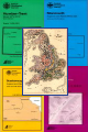
 Geological Poster Maps of the British Isles
These maps provide an overview of the geology of the British Isles in general or the United Kingdom in particular. They are most suitable as wall posters.
Geological Poster Maps of the British Isles
These maps provide an overview of the geology of the British Isles in general or the United Kingdom in particular. They are most suitable as wall posters.
 World Mineral Statistics
The BGS maintains one of the largest databases in the world on the production and trade of minerals.
World Mineral Statistics comprises descriptive statistics for individual countries, by mass or volume, on the production and trade of 65 mineral commodities and approximately 200 sub-commodities.
World Mineral Statistics
The BGS maintains one of the largest databases in the world on the production and trade of minerals.
World Mineral Statistics comprises descriptive statistics for individual countries, by mass or volume, on the production and trade of 65 mineral commodities and approximately 200 sub-commodities.
 UKOOA Volumes: Lithostratigraphic Nomenclatures
Lithostratigraphic nomenclature volumes were produced in association with the UK Offshore Operators’ Association. They are in the form of atlases which provide stratigraphical correlations across the North Sea Basin.
UKOOA Volumes: Lithostratigraphic Nomenclatures
Lithostratigraphic nomenclature volumes were produced in association with the UK Offshore Operators’ Association. They are in the form of atlases which provide stratigraphical correlations across the North Sea Basin.
 Geochemistry, Miscellaneous
The BGS produces a range of reports and maps on gechemical topics and issues, though only a small number of these are offered as formal publications. For information on the wider range of unpublished reports and maps contact the Sales Desk.
Geochemistry, Miscellaneous
The BGS produces a range of reports and maps on gechemical topics and issues, though only a small number of these are offered as formal publications. For information on the wider range of unpublished reports and maps contact the Sales Desk.
 1:50 000 Geological Maps - England and Wales
1:50 000 Series geological maps for England & Wales are produced in landscape format, each covering an area of approximately 20km north-south and 30km east-west.
1:50 000 Geological Maps - England and Wales
1:50 000 Series geological maps for England & Wales are produced in landscape format, each covering an area of approximately 20km north-south and 30km east-west.
 UK Minerals Yearbook
An annual publication providing comprehensive statistical data on mineral production, consumption and trade; estimates of production for major mineral commodities and a commentary on the UK's mineral industry.
UK Minerals Yearbook
An annual publication providing comprehensive statistical data on mineral production, consumption and trade; estimates of production for major mineral commodities and a commentary on the UK's mineral industry.
 GeoSections Vertical Sections
Place two points on a map to define a line and obtain a predicted cross section of the modelled geological units.
GeoSections Vertical Sections
Place two points on a map to define a line and obtain a predicted cross section of the modelled geological units.
 Miscellaneous Technical and Research Reports
Unpublished or "open-file" reports on various aspects of UK geology.
Miscellaneous Technical and Research Reports
Unpublished or "open-file" reports on various aspects of UK geology.
 Mineral Dossiers and Monographs
These publications provide basic information on key economic minerals occurring within the UK. Although information on production may be out-of-date these inexpensive publications provide much useful information which is not available elsewhere.
Mineral Dossiers and Monographs
These publications provide basic information on key economic minerals occurring within the UK. Although information on production may be out-of-date these inexpensive publications provide much useful information which is not available elsewhere.
 Technical and Research Reports
The BGS (previously known as the Institute of Geological Sciences) produces a wide range of geoscience reports in both published and unpublished form.
Technical and Research Reports
The BGS (previously known as the Institute of Geological Sciences) produces a wide range of geoscience reports in both published and unpublished form.
 Non-BGS geoscience maps
Sorry, description not currently available.
Non-BGS geoscience maps
Sorry, description not currently available.
 1:25 000 Classical Areas Maps
A series of maps at 1:25 000 scale for areas of outstanding geological interest.
1:25 000 Classical Areas Maps
A series of maps at 1:25 000 scale for areas of outstanding geological interest.
 Geological Memoirs & Brief Sheet Explanations
Geological memoirs are usually available to accompany each of the 1:50 000 series (and the earlier one-inch series) geological map sheets.
Geological Memoirs & Brief Sheet Explanations
Geological memoirs are usually available to accompany each of the 1:50 000 series (and the earlier one-inch series) geological map sheets.
 Classical Areas Booklets Series
Descriptions of the geology of parts of Britain which are of special geological interest. Several of these booklets compliment the 1:25 000 scale"Classical Areas" geological maps.
Classical Areas Booklets Series
Descriptions of the geology of parts of Britain which are of special geological interest. Several of these booklets compliment the 1:25 000 scale"Classical Areas" geological maps.
 Custom 1:50 000 Geological Maps
Customise your own 1:50 000 Geological Map.
Custom 1:50 000 Geological Maps
Customise your own 1:50 000 Geological Map.
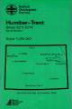
 1:100 000 Scottish Islands Geological Maps
For outlying Scottish Islands maps are published at the 1:100 000 scale instead of the larger scale 1:50 000 scale; the information contained is similar.
1:100 000 Scottish Islands Geological Maps
For outlying Scottish Islands maps are published at the 1:100 000 scale instead of the larger scale 1:50 000 scale; the information contained is similar.
 Historical Maps and Books
This section includes reproductions of several historic maps, by William Smith and James MacCulloch, plus books on related topics.
Historical Maps and Books
This section includes reproductions of several historic maps, by William Smith and James MacCulloch, plus books on related topics.
 Scottish Natural Heritage Books and Guides
Scottish Natural Heritage, in association with the BGS, have produced a range of booklets on the geology and landscape of several important tourist regions of Scotland.
Scottish Natural Heritage Books and Guides
Scottish Natural Heritage, in association with the BGS, have produced a range of booklets on the geology and landscape of several important tourist regions of Scotland.
These booklets are aimed at non-specialist readers and are illustrated with photographs and diagrams describing the evolution of the lansdcape in relation to the underlying geology.
 Stratigraphic Nomenclature (BGS)
These publications describe the stratigraphy of UK onshore and offshore areas.
Stratigraphic Nomenclature (BGS)
These publications describe the stratigraphy of UK onshore and offshore areas.
 Mineral Assessment Reports (Bulk minerals)
These reports are on the assessment of bulk mineral resources of areas within the UK.
Mineral Assessment Reports (Bulk minerals)
These reports are on the assessment of bulk mineral resources of areas within the UK.
 Miscellaneous books on earth science topics
Books on a wide range of earth-science and related topics, from the BGS and other publishers.
Miscellaneous books on earth science topics
Books on a wide range of earth-science and related topics, from the BGS and other publishers.
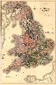
 1:50 000 Geological Maps
Geological maps show the nature, extent and relative stratigraphical age of the different rocks within a district.
1:50 000 Geological Maps
Geological maps show the nature, extent and relative stratigraphical age of the different rocks within a district.
 Stratigraphy and Structural Maps and Atlases
Publications which provide information on major structural features and stratigraphical correlations in and around the United Kingdom.
Stratigraphy and Structural Maps and Atlases
Publications which provide information on major structural features and stratigraphical correlations in and around the United Kingdom.
 Geophysical Publications
Small scale geophysical maps are available covering the British Isles in either single or double sheets. The themes covered include gravity (Bouguer & Free-air) maps, magnetic maps, Natural Environment Radioactivity Survey Series Maps. For information on other reports on particular districts or specific applications contact the Sales Desk.
Geophysical Publications
Small scale geophysical maps are available covering the British Isles in either single or double sheets. The themes covered include gravity (Bouguer & Free-air) maps, magnetic maps, Natural Environment Radioactivity Survey Series Maps. For information on other reports on particular districts or specific applications contact the Sales Desk.
 Offshore Regional Reports
These reports describe the offshore geology of the United Kingdom and complement the regional geology guides
which cover the onshore areas.
Offshore Regional Reports
These reports describe the offshore geology of the United Kingdom and complement the regional geology guides
which cover the onshore areas.
 Mineral Exploration Papers
Several series of reports have been produced examining the mineral resources of the UK. Metalliferous mineral exploration surveys are covered by Mineral Reconnaissance Reports and bulk constructional or industrial minerals (principally aggregates and limestone) by Mineral Assessment Reports. These surveys were undertaken between 1971 and 1997.
Mineral Exploration Papers
Several series of reports have been produced examining the mineral resources of the UK. Metalliferous mineral exploration surveys are covered by Mineral Reconnaissance Reports and bulk constructional or industrial minerals (principally aggregates and limestone) by Mineral Assessment Reports. These surveys were undertaken between 1971 and 1997.
 Other Medium Scale Geological Maps
Geological maps for some parts of the United Kingdom are available at smaller scales than the main 1:50 000 geological maps.
Other Medium Scale Geological Maps
Geological maps for some parts of the United Kingdom are available at smaller scales than the main 1:50 000 geological maps.
 Geochemistry, geophysics and hydrogeology
Publications on the geochemistry, geophysics and hydrogeology of the UK include thematic maps, geochemical atlases, and reports aimed at geologists and other professional users.
Geochemistry, geophysics and hydrogeology
Publications on the geochemistry, geophysics and hydrogeology of the UK include thematic maps, geochemical atlases, and reports aimed at geologists and other professional users.
 1:50 000 Geological Maps - Scotland
The individual 1:50 000 Series geological maps for Scotland are produced in portrait format, each covering an area of approximately 30km north-south and 20km east-west.
1:50 000 Geological Maps - Scotland
The individual 1:50 000 Series geological maps for Scotland are produced in portrait format, each covering an area of approximately 30km north-south and 20km east-west.
 Geological Memoirs - Northern Ireland
Geological memoirs for each of the 1:50 000 series (and the earlier one-inch series) geological map sheets.
Geological Memoirs - Northern Ireland
Geological memoirs for each of the 1:50 000 series (and the earlier one-inch series) geological map sheets.
 Minerals publications
A wide variety of publications are available on the mineral resources of the UK.
Minerals publications
A wide variety of publications are available on the mineral resources of the UK.
 1:250 000 Geological Map of Wales
A bilingual map – Welsh and English – showing the Solid (bedrock) geology of Wales. Published in 1994.
1:250 000 Geological Map of Wales
A bilingual map – Welsh and English – showing the Solid (bedrock) geology of Wales. Published in 1994.
 Non BGS geoscience maps
Various geoscience maps from other publishers, ranging from small scale regional maps to one of local importance.
Non BGS geoscience maps
Various geoscience maps from other publishers, ranging from small scale regional maps to one of local importance.
 1:1 million UK, Ireland and Continental Shelf
These maps give whole-country coverage for the United Kingdom and parts of continental shelf areas around the British Isles.
1:1 million UK, Ireland and Continental Shelf
These maps give whole-country coverage for the United Kingdom and parts of continental shelf areas around the British Isles.
 Groundwater Vulnerability Maps
The Soil Survey and Land Research Centre and the BGS were commissioned by the Environment Agency to prepare groundwater vulnerability maps of England and Wales at a scale of 1:100 000. These maps identify areas in which groundwater resources require protection from potentially polluting activities. The maps are designed to be used by planners, developers, consultants and regulatory bodies to ensure that developments conform to the Environment Agency's Policy and Practice for the Protection of Groundwater.
Groundwater Vulnerability Maps
The Soil Survey and Land Research Centre and the BGS were commissioned by the Environment Agency to prepare groundwater vulnerability maps of England and Wales at a scale of 1:100 000. These maps identify areas in which groundwater resources require protection from potentially polluting activities. The maps are designed to be used by planners, developers, consultants and regulatory bodies to ensure that developments conform to the Environment Agency's Policy and Practice for the Protection of Groundwater.
 Mineral Production Information & Statistics
The BGS maintains one of the largest databases in the world on the production and trade of minerals.
Mineral Production Information & Statistics
The BGS maintains one of the largest databases in the world on the production and trade of minerals.
 1:50 000 Geological Maps - Northern Ireland
The individual 1:50 000 Series geological maps for Northern Ireland are produced in landscape format, each covering an area of approximately 20km north-south and 30km east-west.
1:50 000 Geological Maps - Northern Ireland
The individual 1:50 000 Series geological maps for Northern Ireland are produced in landscape format, each covering an area of approximately 20km north-south and 30km east-west.
 Geological Memoirs - England and Wales
Geological memoirs, Brief Sheet Explanations and Sheet Descriptions for each of the 1:50 000 series (and the earlier one-inch series) geological map sheets.
Geological Memoirs - England and Wales
Geological memoirs, Brief Sheet Explanations and Sheet Descriptions for each of the 1:50 000 series (and the earlier one-inch series) geological map sheets.
 Mineral Resource Planning Maps & Reports
A series of Mineral Resource and Planning Constraint Reports and Maps for various administrative areas in England and Wales prepared under the Department of the Environment, Transport and the Regions (DETR) Research Project "Mineral Resource Information for Development Plans".
Mineral Resource Planning Maps & Reports
A series of Mineral Resource and Planning Constraint Reports and Maps for various administrative areas in England and Wales prepared under the Department of the Environment, Transport and the Regions (DETR) Research Project "Mineral Resource Information for Development Plans".
 BGS International Regional Geochemistry Data
 CDs
BGS International Regional Geochemistry Data
BGS International Regional Geochemistry Data CDs
 Groundwater Vulnerability Maps
Soil Survey and Land Research Centre / BGS groundwater vulnerability maps of England and Wales at a scale of 1:100 000.
Groundwater Vulnerability Maps
Soil Survey and Land Research Centre / BGS groundwater vulnerability maps of England and Wales at a scale of 1:100 000.
 Geochemical Atlases
These atlases provide a systematic picture of the geochemistry of the whole of Britain.
Geochemical Atlases
These atlases provide a systematic picture of the geochemistry of the whole of Britain.
 Historical Maps & Books
This section includes reproductions of historic maps by William Smith and John MacCulloch, plus associated books and guides.
Historical Maps & Books
This section includes reproductions of historic maps by William Smith and John MacCulloch, plus associated books and guides.
 Mineral Reconnaissance Reports (Metalliferous)
Series of reports that have been produced examining the mineral resources of the UK.
Mineral Reconnaissance Reports (Metalliferous)
Series of reports that have been produced examining the mineral resources of the UK.
 1:250 000 Northern Ireland Series
A single sheet geological map of Northern Ireland: available in 'Solid' (bedrock) and 'Quaternary' (superficial or recent deposits) versions.
1:250 000 Northern Ireland Series
A single sheet geological map of Northern Ireland: available in 'Solid' (bedrock) and 'Quaternary' (superficial or recent deposits) versions.
 Hydrogeology Reports
These reports cover aspects of groundwater availability, exploitation and quality in the United Kingdom.
Hydrogeology Reports
These reports cover aspects of groundwater availability, exploitation and quality in the United Kingdom.
 Geophysical Maps
A variety of maps on geophysical topics including gravity, magnetic and radioactivity maps.
Geophysical Maps
A variety of maps on geophysical topics including gravity, magnetic and radioactivity maps.
 Geological maps
 show the nature, extent and relative stratigraphical age of the different rocks within a district.
Geological maps
Geological maps show the nature, extent and relative stratigraphical age of the different rocks within a district.
 Falkland Islands Maps and Reports
These publications were produced in association with the Falklands Islands Government. They cover mainly onshore areas.
Falkland Islands Maps and Reports
These publications were produced in association with the Falklands Islands Government. They cover mainly onshore areas.
 1:625 000 United Kingdom Landmass
These geological maps are available as North and South sheets, each covering half of Britain, and in two versions: Solid (bedrock) geology and Quaternary geology (superficial or ‘drift’ deposits). The maps also show the sheet outlines of the 1:50 000 series geological maps.
1:625 000 United Kingdom Landmass
These geological maps are available as North and South sheets, each covering half of Britain, and in two versions: Solid (bedrock) geology and Quaternary geology (superficial or ‘drift’ deposits). The maps also show the sheet outlines of the 1:50 000 series geological maps.
 Mineral Assessment Reports
These reports are on the assessment of bulk mineral resources of areas within the UK. Over 140 reports were produced between 1971 and 1990 as part of a national stock-take of inductrial minerals, funded by the (then) Department of the Environment. The minerals covered are: sand and gravel, hard rock aggregates, limestone, conglomerate, and celestite (one report). The reports were produced using data gathered from extensive borehole surveys and contain qualitative and quantitative data on lithology, composition, particle size analysis and other information of commercial value. Boreholes were drilled at a density of one per 1km square. Resource evaluation, based on statistical assessments, together with summary borehole information and geology, are all shown on an Ordnance Survey National Grid map at a scale of 1:25 000. In addition to the interpretative information and assessments, the reports contain abridged borehole logs including chemical or particle-size information as appropriate.
Mineral Assessment Reports
These reports are on the assessment of bulk mineral resources of areas within the UK. Over 140 reports were produced between 1971 and 1990 as part of a national stock-take of inductrial minerals, funded by the (then) Department of the Environment. The minerals covered are: sand and gravel, hard rock aggregates, limestone, conglomerate, and celestite (one report). The reports were produced using data gathered from extensive borehole surveys and contain qualitative and quantitative data on lithology, composition, particle size analysis and other information of commercial value. Boreholes were drilled at a density of one per 1km square. Resource evaluation, based on statistical assessments, together with summary borehole information and geology, are all shown on an Ordnance Survey National Grid map at a scale of 1:25 000. In addition to the interpretative information and assessments, the reports contain abridged borehole logs including chemical or particle-size information as appropriate.
 Overseas Memoirs
Memoirs produced by the Overseas Geological Survey and Institute of Geological Sciences prior to c.1985.
Overseas Memoirs
Memoirs produced by the Overseas Geological Survey and Institute of Geological Sciences prior to c.1985.
 Tectonic and Structural Maps
Maps showing the major structural features of UK geology.
Tectonic and Structural Maps
Maps showing the major structural features of UK geology.
 Geological Posters
, Jigsaws and more
Geological Posters
Geological Posters, Jigsaws and more
 Education and leisure
The BGS publishes its own range of non-specialist books, guides and posters on geology and related themes under the Earthwise™ trademark.
Education and leisure
The BGS publishes its own range of non-specialist books, guides and posters on geology and related themes under the Earthwise™ trademark.
 Miscellaneous Overseas Publications
Miscellaneous publications produced by the Overseas Geological Survey and Institute of Geological Science prior to 1985.
Miscellaneous Overseas Publications
Miscellaneous publications produced by the Overseas Geological Survey and Institute of Geological Science prior to 1985.
 Overseas Mineral Resources
Publications on geology and mineral resources produced by the Overseas Geological Survey and Institute of Geological Sciences prior to c. 1985
Overseas Mineral Resources
Publications on geology and mineral resources produced by the Overseas Geological Survey and Institute of Geological Sciences prior to c. 1985
 Overseas and technical publications
Order BGS printed products including maps, sheet explanations and regional guides.
Overseas and technical publications
Order BGS printed products including maps, sheet explanations and regional guides.
 Hydrogeological Maps
Hydrogeological maps of the UK provide information on major aquifers, including geological and lithological information, surface drainage systems and water quality issues. Up-to-date information on UK hydrogeology is held in the National Groundwater Archive.
Hydrogeological Maps
Hydrogeological maps of the UK provide information on major aquifers, including geological and lithological information, surface drainage systems and water quality issues. Up-to-date information on UK hydrogeology is held in the National Groundwater Archive.
 Offshore Regional Reports
These reports describe the offshore geology of the United Kingdom and complement the Regional Geology Guides which cover the onshore areas. The reports cover all aspects of the geology of a region, from the most recently formed sediments to the deep structure of the crust, and include a chapter on economic geology. Maps which may be used in conjunction with these reports are indicated below :
Offshore Regional Reports
These reports describe the offshore geology of the United Kingdom and complement the Regional Geology Guides which cover the onshore areas. The reports cover all aspects of the geology of a region, from the most recently formed sediments to the deep structure of the crust, and include a chapter on economic geology. Maps which may be used in conjunction with these reports are indicated below :
Regional Geology Guides
1:250 000 Geological Maps (UTM Series)
 Overseas Books & Reports
The BGS publish books and reports on the geological, geophysical and resources of several countries.
Overseas Books & Reports
The BGS publish books and reports on the geological, geophysical and resources of several countries.
 Small Scale and Poster Maps
These maps give whole-country coverage for the United Kingdom on a variety of geological themes; many
maps also cover continental shelf areas.
Small Scale and Poster Maps
These maps give whole-country coverage for the United Kingdom on a variety of geological themes; many
maps also cover continental shelf areas.
 Hydrogeological Maps
Hydrogeological maps of the UK provide information on major aquifers, including geological and lithological information, surface drainage systems and water quality issues.
Hydrogeological Maps
Hydrogeological maps of the UK provide information on major aquifers, including geological and lithological information, surface drainage systems and water quality issues.
 Geological books and guides
The BGS publishes a wide range of books and guides on geological topics, ranging from detailed descriptions of local geology to the geological overview of the UK's regions.
Geological books and guides
The BGS publishes a wide range of books and guides on geological topics, ranging from detailed descriptions of local geology to the geological overview of the UK's regions.
 Map Symbols and Lithological Ornaments
The British Geological Survey has brought together in one document (Cartographic standard geological symbol index) a complete listing of all its geological cartographic symbols, linestyles and lithological ornaments in current usage. They represent a British Standard. The symbols are used at all scales and are independent of ornament and colour. The symbols are indexed by geological classification and by description, and are illustrated by symbol reference name. These reference names are an abbreviated form of their description.
Map Symbols and Lithological Ornaments
The British Geological Survey has brought together in one document (Cartographic standard geological symbol index) a complete listing of all its geological cartographic symbols, linestyles and lithological ornaments in current usage. They represent a British Standard. The symbols are used at all scales and are independent of ornament and colour. The symbols are indexed by geological classification and by description, and are illustrated by symbol reference name. These reference names are an abbreviated form of their description.
This report represents a revised version (3) of the first phase of a project to make BGS map symbols more widely available.
 Open Borehole Records
A record of boreholes, shafts and wells from all forms of drilling and site investigation work. Boreholes range from one metre to several thousand metres deep.
Open Borehole Records
A record of boreholes, shafts and wells from all forms of drilling and site investigation work. Boreholes range from one metre to several thousand metres deep.
 Hydrogeology Reports
Reports on the hydrogeology of the UK.
Hydrogeology Reports
Reports on the hydrogeology of the UK.
 Standards and Reference Materials
The BGS has prepared a number of Analysed Standards for selected industrial minerals, plus a UK Reference Sample for bioaccessibility and total element determinations.
Standards and Reference Materials
The BGS has prepared a number of Analysed Standards for selected industrial minerals, plus a UK Reference Sample for bioaccessibility and total element determinations.
 Institute of Geological Sciences Reports
The Institute of Geological Sciences (forerunner of the BGS) published a series of reports, covering many geological topics, between 1967 and 1985.
Institute of Geological Sciences Reports
The Institute of Geological Sciences (forerunner of the BGS) published a series of reports, covering many geological topics, between 1967 and 1985.
 Falkland Islands Maps and Reports
These publications were produced in association with the Falklands Islands Government. They cover mainly onshore areas.
Falkland Islands Maps and Reports
These publications were produced in association with the Falklands Islands Government. They cover mainly onshore areas.