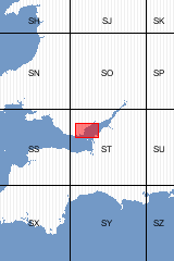
More products covering this area
 Books and Maps covering this area × -
Inner Bristol Channel and Severn Estuary (Pre-Q) E263, E179, E295 [Flat Map]
Cardiff (S) [Flat Map]
Rhayader (SwD) [Flat Map]
Taunton (S&D) [Flat Map]
 ST06 (1:10 000 map sheet) × -
1:10,000 Geological Map of ST06NE
 ST07 (1:10 000 map sheet) × -
1:10,000 Geological Map of ST07NE
1:10,000 Geological Map of ST07SE
 ST08 (1:10 000 map sheet) × -
1:10,000 Geological Map of ST08SE
 ST16 (1:10 000 map sheet) × -
1:10,000 Geological Map of ST16NW
1:10,000 Geological Map of ST16NE
 ST17 (1:10 000 map sheet) × -
1:10,000 Geological Map of ST17SW
1:10,000 Geological Map of ST17NW
 ST18 (1:10 000 map sheet) × -
1:10,000 Geological Map of ST18SE
1:10,000 Geological Map of ST18SW
 ST26 (1:10 000 map sheet) × -
1:10,000 Geological Map of ST26SW
 ST27 (1:10 000 map sheet) × -
1:10,000 Geological Map of ST27SW
1:10,000 Geological Map of ST27NE
 ST28 (1:10 000 map sheet) × -
1:10,000 Geological Map of ST28SE
 ST36 (1:10 000 map sheet) × -
1:10,000 Geological Map of ST36SE
1:10,000 Geological Map of ST36NE
1:10,000 Geological Map of ST36SW
1:10,000 Geological Map of ST36NW
 ST38 (1:10 000 map sheet) × -
1:10,000 Geological Map of ST38SE
1:10,000 Geological Map of ST38SW

