
Four products found
Sort by

| Format | Flat Map | ISBN | 0751833819 |
|---|---|---|---|
| Scale | 1:50 000 | Sheet(s) Covered | E193 |
| Version | S&D | Year Published | 2003 |

| Format | Folded Map | ISBN | 0751833827 |
|---|---|---|---|
| Scale | 1:50 000 | Sheet(s) Covered | E193 |
| Year Published | 2003 | ||

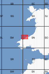
Sheet Explanations provide a brief description and interpretation of the geology of the relevant BGS 1:50 000 scale map sheet area. More detailed geological information for the same area is available via the Sheet Descriptions. Sheet Explanations are printed A5 booklets and are available either singly, or as a pack together with the relevant 1:50 000 scale map, where this map is available. Much of the area described in this Sheet Explanation lies within the Pembrokeshire National Park. Spectacular coastal cliffs between Dinas Head and Cemaes Head reach heights of 160m above sea level and inland, deep valleys and gorges incise into the smooth, rolling landscape. The bedrock of the district is deformed Ordovician deep water sedimentary rocks faulted and metamorphosed around 400 million years ago.
| Author | Davies, J R et al | ISBN | 0852724349 |
|---|---|---|---|
| Scale | 1:50 000 | Sheet(s) Covered | E193 |
| Year Published | 2003 | ||

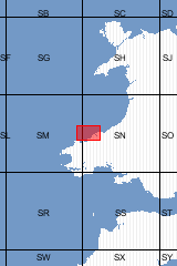
This pack contains a Sheet Explanation for the district and the complementary 1:50 000 scale Bedrock Geology and Superficial Deposits map (folded). Sheet Explanations provide a brief description and interpretation of the geology of the relevant map sheet area. The A5 Sheet Explanation booklet and the map are supplied in a transparent wallet. While it is possible to buy the map and Sheet Explanation separately, buying them together as map pack saves you £3. Much of the area described in this Sheet Explanation lies within the Pembrokeshire National Park. Spectacular coastal cliffs between Dinas Head and Cemaes Head reach heights of 160m above sea level and inland, deep valleys and gorges incise into the smooth, rolling landscape. The bedrock of the district is deformed Ordovician deep water sedimentary rocks faulted and metamorphosed around 400 million years ago. [Booklet and Map Pack]
| Author | Davies J R et al | Format | Booklet and Map Pack |
|---|---|---|---|
| ISBN | XEM193SEM | Scale | 1:50 000 |
| Sheet(s) Covered | E193 | Year Published | 2003 |
Four products found
Sort by