
Four products found
Sort by

| Format | Folded Map | ISBN | 0751834297 |
|---|---|---|---|
| Scale | 1:50 000 | Sheet(s) Covered | E213 |
| Version | B&Sup | Year Published | 2007 |

| Format | Flat Map | ISBN | 0751834289 |
|---|---|---|---|
| Scale | 1:50 000 | Sheet(s) Covered | E213 |
| Version | B&Sup | Year Published | 2005 |

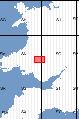
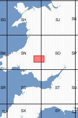
Sheet Explanations provide a brief description and interpretation of the geology of the relevant BGS 1:50 000 scale map sheet area. More detailed geological information for the same area is available via the Sheet Descriptions. Sheet Explanations are printed A5 booklets and are available either singly, or as a pack together with the relevant 1:50 000 scale map, where this map is available. The district lies mainly in the county of Powys, with a small part in the west in Carmarthenshire. Much of the southern part lies in the Brecon Beacons National Park, with the summits of the Brecon Beacons, Fforest Fawr and Mynydd Du lying along the southern margin. The north-facing scarps and glacial cwms of these mountains provide some of the most dramatic scenery in southern Britain, as well as its highest point in Pen y Fan at 886 m. A large area of Mynydd Eppynt north of Sennybridge is owned by the Ministry of Defence and used as a military training area (SENTA). Hill farming provides the main contribution to the district's economy, but tourism and outdoor leisure activities continue to grow in importance. Brecon is the main population centre, strategically placed at the confluence of the Usk and Honddu rivers. It dates back to pre-Roman times, when an Iron Age fort was established on Pen-y-crug; its cathedral and castle are Norman. In addition to being a market town and tourist centre, Brecon is home to the Royal Regiment of Wales.
| Author | Barclay, WJ et al | ISBN | 0852725116 |
|---|---|---|---|
| Sheet(s) Covered | E213 | Year Published | 2005 |

This pack contains a Sheet Explanation for the district and the complementary 1:50 000 scale Bedrock Geology and Superficial Deposits map (folded). Sheet Explanations provide a brief description and interpretation of the geology of the relevant map sheet area. The A5 Sheet Explanation booklet and the map are supplied in a transparent wallet. While it is possible to buy the map and Sheet Explanation separately, buying them together as map pack saves you £3. The district lies mainly in the county of Powys, with a small part in the west in Carmarthenshire. Much of the southern part lies in the Brecon Beacons National Park, with the summits of the Brecon Beacons, Fforest Fawr and Mynydd Du lying along the southern margin. The north-facing scarps and glacial cwms of these mountains provide some of the most dramatic scenery in southern Britain, as well as its highest point in Pen y Fan at 886 m. A large area of Mynydd Eppynt north of Sennybridge is owned by the Ministry of Defence and used as a military training area (SENTA). Hill farming provides the main contribution to the district's economy, but tourism and outdoor leisure activities continue to grow in importance. Brecon is the main population centre, strategically placed at the confluence of the Usk and Honddu rivers. It dates back to pre-Roman times, when an Iron Age fort was established on Pen-y-crug; its cathedral and castle are Norman. In addition to being a market town and tourist centre, Brecon is home to the Royal Regiment of Wales. [Booklet and Map Pack]
| Format | Booklet and Map Pack | ISBN | XEM213SEM |
|---|---|---|---|
| Sheet(s) Covered | E213 | Year Published | 2005 |
Four products found
Sort by