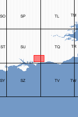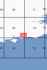

6 products found
Sort by

For clarity, parts of the solid geology shown on this map have been simplified [Folded Map]
| Format | Folded Map | ISBN | 0751829757 |
|---|---|---|---|
| Sheet(s) Partially Covered | E332 | Scale | 1:50 000 |
| Sheet(s) Covered | E317 | Version | S&D |
| Year Published | 1996 | ||

For clarity, parts of the solid geology shown on this map have been simplified [Flat Map]
| Format | Flat Map | ISBN | 0751829749 |
|---|---|---|---|
| Sheet(s) Partially Covered | E332 | Scale | 1:50 000 |
| Sheet(s) Covered | E317 | Version | S&D |
| Year Published | 1996 | ||

Sheet Explanations provide a brief description and interpretation of the geology of the relevant BGS 1:50 000 scale map sheet area. More detailed geological information for the same area is available via the Sheet Descriptions. Sheet Explanations are printed A5 booklets and are available either singly, or as a pack together with the relevant 1:50 000 scale map, where this map is available. The Chichester and Bognor district lies on the south-western edge of the Weald, stretching from the South Downs to the coast at Selsey Bill. Geologically, it lies within the Wessex basin, on the southern limb of the Wealden Anticlinorium. The oldest formations known to be present at depth are of Devonian and Carboniferous age, but the main period of basin development and sedimentary deposition occurred during the Mesozoic, and a thick sequence of Jurassic strata underlies the Cretaceous rocks that outcrop at the surface. Sedimentary deposition was eventually terminated in mid-Cainozoic times, when extensive earth movements resulted in the formation of a series of large en échelon folds, each marking major faults at depth. This brief account describes the geology of the district. The oldest exposed strata are part of the Lower Cretaceous Wealden 'Group'. Passing south, these are successively overlain by the Lower Greensand Group, Gault and Upper Greensand formations and the Upper Cretaceous Chalk Group. Cainozoic (Palaeogene) strata underlie the broad coastal plain, and include the Reading Formation, London Clay Formation and the Bracklesham Group. [Book]
| Author | Aldiss, D.T. | Format | Book |
|---|---|---|---|
| ISBN | 0852724357 | Sheet(s) Covered | E317 |
| Year Published | 2003 | ||

This pack contains a Sheet Explanation for the district and the complementary 1:50 000 scale Bedrock Geology and Superficial Deposits map (folded). Sheet Explanations provide a brief description and interpretation of the geology of the relevant map sheet area. The A5 Sheet Explanation booklet and the map are supplied in a transparent wallet. While it is possible to buy the map and Sheet Explanation separately, buying them together as map pack saves you £3. The Chichester and Bognor district lies on the south-western edge of the Weald, stretching from the South Downs to the coast at Selsey Bill. Geologically, it lies within the Wessex basin, on the southern limb of the Wealden Anticlinorium. The oldest formations known to be present at depth are of Devonian and Carboniferous age, but the main period of basin development and sedimentary deposition occurred during the Mesozoic, and a thick sequence of Jurassic strata underlies the Cretaceous rocks that outcrop at the surface. Sedimentary deposition was eventually terminated in mid-Cainozoic times, when extensive earth movements resulted in the formation of a series of large en échelon folds, each marking major faults at depth. This brief account describes the geology of the district. The oldest exposed strata are part of the Lower Cretaceous Wealden 'Group'. Passing south, these are successively overlain by the Lower Greensand Group, Gault and Upper Greensand formations and the Upper Cretaceous Chalk Group. Cainozoic (Palaeogene) strata underlie the broad coastal plain, and include the Reading Formation, London Clay Formation and the Bracklesham Group. [Booklet and Map Pack]
| Author | Aldiss D T | Format | Booklet and Map Pack |
|---|---|---|---|
| Sheet(s) Covered | E317 | Year Published | 2003 |

Sheet descriptions provide detailed, in-depth geological information for the relevant BGS 1:50 000 scale map sheets. Extensive references and information sources are cited.
They are A4 print-on-demand publications which are supplied bound in clear covers. [Report]
| Format | Report | ISBN | 085272425X |
|---|---|---|---|
| Sheet(s) Partially Covered | E332 | Reprographic | DP |
| Sheet(s) Covered | E317 | Year Published | 2002 |

Sheet Explanations provide a brief description and interpretation of the geology of the relevant BGS 1:50 000 scale map sheet area. More detailed geological information for the same area is available via the Sheet Descriptions. Sheet Explanations are printed A5 booklets and are available either singly, or as a pack together with the relevant 1:50 000 scale map, where this map is available. The Chichester and Bognor district lies on the south-western edge of the Weald, stretching from the South Downs to the coast at Selsey Bill. Geologically, it lies within the Wessex basin, on the southern limb of the Wealden Anticlinorium. The oldest formations known to be present at depth are of Devonian and Carboniferous age, but the main period of basin development and sedimentary deposition occurred during the Mesozoic, and a thick sequence of Jurassic strata underlies the Cretaceous rocks that outcrop at the surface. Sedimentary deposition was eventually terminated in mid-Cainozoic times, when extensive earth movements resulted in the formation of a series of large en échelon folds, each marking major faults at depth. This brief account describes the geology of the district. The oldest exposed strata are part of the Lower Cretaceous Wealden 'Group'. Passing south, these are successively overlain by the Lower Greensand Group, Gault and Upper Greensand formations and the Upper Cretaceous Chalk Group. Cainozoic (Palaeogene) strata underlie the broad coastal plain, and include the Reading Formation, London Clay Formation and the Bracklesham Group.
| Author | Aldiss D T | ISBN | 0852724357 |
|---|---|---|---|
| Sheet(s) Covered | E317 | Year Published | 2003 |
6 products found
Sort by