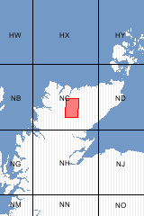
1:50 000 Geological Maps - Scotland

1:50 000 Geological Maps - Scotland

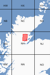
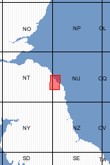
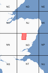
The individual 1:50 000 Series geological maps for Scotland are produced in portrait format, each covering an area of approximately 30km north-south and 20km east-west.

Combined sheets, special sheets and those for coastal districts may have a different coverage.

The map grid used is based on the now-superseded Ordnance Survey One-Inch Sheet Grid for Scotland.

Maps are numbered in pairs, East and West (eg S040E and S040W) with each having its own sheet name.

Maps are normally available in both flat and folded formats.

Browse all sheet names

Viewing 61 to 80 of 494

Page 4 of 25 1 3 4 5 25

Sort by

61 Ben Hee (B) [Folded Map]

Format Folded Map ISBN 9780751835847
Scale 1:50 000 Sheet(s) Covered S108W
Version B Year Published 2009


62 Ben Lomond (S) [Flat Map]

Format Flat Map ISBN 0751809225
Scale 1:50 000 Sheet(s) Covered S038W
Version S Year Published 1987


63 Ben Lomond (S) [Folded Map]

Format Folded Map ISBN 0751809276
Scale 1:50 000 Sheet(s) Covered S038W
Version S Year Published 1987


64 Ben Lomond (S) [REISSUE] [Folded Map]

Author BGS Format Folded Map
ISBN 9780751809275 Scale 1:50 000
Sheet(s) Covered S038 Version S
Year Published 1987  


65 Ben Macdui (B&Sup) [Flat Map]

Format Flat Map ISBN 9780751835434
Scale 1:50 000 Sheet(s) Covered S064E
Version B&Sup Year Published 2008


66 Ben Macdui (B&Sup) [Folded Map]

Format Folded Map ISBN 9780751835441
Scale 1:50 000 Sheet(s) Covered S064E
Version B&Sup Year Published 2008


67 Ben Macdui (B) [Folded Map]

Format Folded Map ISBN 0751835420
Scale 1:50 000 Sheet(s) Covered S064E
Version B Year Published 2008


68 Ben Macdui (B) [Flat Map]

Format Flat Map ISBN 0751835412
Scale 1:50 000 Sheet(s) Covered S064E
Version B Year Published 2008


69 Ben Nevis (S&D) [Flat Map]

Format Flat Map ISBN 9780751837049
Scale 1:63 360 Sheet(s) Covered S053
Version S&D Year Published 1948


70 Ben Nevis (S&D) [Folded Map]

Format Folded Map ISBN 075180231X
Scale 1:63 360 Sheet(s) Covered S053
Version S&D Year Published 1948


71 Ben Wyvis (B&Sup) [Folded Map]

Format Folded Map ISBN 9780751832969
Scale 1:50 000 Sheet(s) Covered S093W
Version B&Sup Year Published 2004


72 Ben Wyvis (B&Sup) [Flat Map]

Format Flat Map ISBN 9780875132952
Scale 1:50 000 Sheet(s) Covered S093W
Version B&Sup Year Published 2004


73 Berwick upon Tweed (S&D) [Flat Map]

This sheet shows the geology for Scotland only. England sheets E001 and E003 cover the English side of the border. [Flat Map]

Format Flat Map ISBN 9780751837018
Scale 1:50 000 Sheet(s) Covered S026
Version S&D Year Published 1969


74 Biggar (D) [Flat Map]

Format Flat Map ISBN 0751809403
Scale 1:50 000 Sheet(s) Covered S024W
Version D Year Published 1981


75 Biggar (D) [Folded Map]

Format Folded Map ISBN 0751809454
Scale 1:50 000 Sheet(s) Covered S024W
Version D Year Published 1981


76 Biggar (S) [Flat Map]

Format Flat Map ISBN 0751809306
Scale 1:50 000 Sheet(s) Covered S024W
Version S Year Published 1980


77 Biggar (S) [Folded Map]

Format Folded Map ISBN 0751809357
Scale 1:50 000 Sheet(s) Covered S024W
Version S Year Published 1980


78 Blackwater (S&D) [Folded Map]

Format Folded Map ISBN 0751809780
Scale 1:50 000 Sheet(s) Covered S054W
Version S&D Year Published 1974


79 Blackwater (S&D) [Flat Map]

Format Flat Map ISBN 075180973X
Scale 1:50 000 Sheet(s) Covered S054W
Version S&D Year Published 1974


80 Braemar (S) [Flat Map]

Format Flat Map ISBN 0751809446
Scale 1:50 000 Sheet(s) Covered S065W
Version S Year Published 1989


Viewing 61 to 80 of 494

Page 4 of 25 1 3 4 5 25

Sort by

Out of print maps

For some districts copies of out of print maps are available through our 'Print-on-demand' service.

These maps are printed as required (normally within 2 days) using a high resolution, high permancence digital printer: the maps are supplied in flat form only: they are indicated by '(POD)' in the list.