Geological map extracts GeoReport

Price £37.80(inc VAT)
Set location Enter a UK postcode or grid reference to locate your GeoReport
OR
Send a site plan
This report will be particularly useful for users carrying out site investigations or those who have a general interest in their local geology.
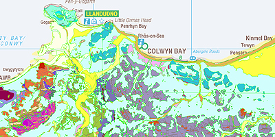
The report contains geological map extracts for the area around a site, taken from the BGS digital geological map of Great Britain at 1:10 000 scale where available and at 1:50 000 scale where there is no digital geological mapping at 1:10 000 scale. For further information see BGS Geology datasets.
The layers include artificial deposits, landslip, superficial and bedrock geology and a combined map showing all four layers.
This report is also available as a module, and is included free of charge in the Site Investigation Borehole, Bespoke Area Assessment, Radon : England and Wales, Radon : Scotland and Natural Ground Stability reports.
Notes:
Map extracts are not available in some areas of the UK. See the report availability map below.
All prices include delivery.

